About Niger
Niger is a large landlocked country in West Africa, named after the Niger River. Much of the country lies within the Sahara Desert, while the south reaches the Sahel and contains the majority of the population.
Niger is known for ancient trans-Saharan trade routes, Tuareg culture, uranium resources, the historic city of Agadez and the vast landscapes of the Sahara.
CapitalNiamey
RegionWest Africa
PopulationAbout 25 million
CurrencyWest African CFA franc
Official languageFrench
Income groupLow income
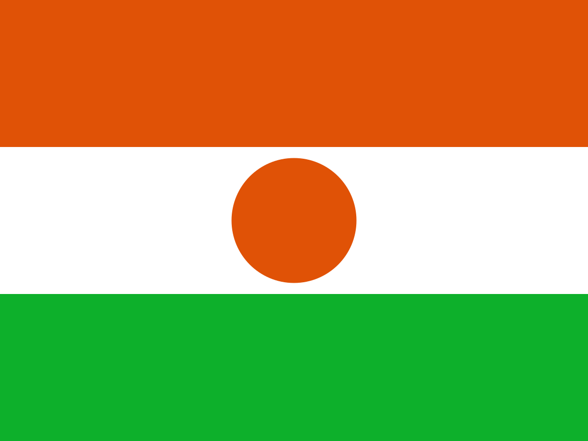
The flag of Niger
Niger's national flag has three equal horizontal bands of orange, white and green, with an orange disc in the centre of the white band.
The colours are commonly connected with Niger's landscape and natural environment.
Orange represents the Sahara, white represents purity, and green represents the fertile southern regions. The central orange disc represents the sun.
The flag was adopted when Niger became independent from France in 1960.
The orange band
The orange represents the Sahara Desert, which covers a large part of northern Niger.
It also reflects the country's dramatic desert landscapes and the importance of the Sahara to Niger's geography and history.
The white band
The central white band is commonly associated with purity and peace.
It also creates a strong background for the orange sun at the centre of the flag.
The green band
The green represents the fertile lands and vegetation of southern Niger.
Most of Niger's population lives in the south, where rainfall is greater and farming is more practical than in the Sahara.
The orange sun
The orange circle in the centre of the flag represents the sun.
The symbol is especially appropriate for a country where sunlight, heat and the desert environment are major features of everyday life.
A short history of Niger
Niger's history has been shaped by the Sahara, trans-Saharan trade, powerful West African states, nomadic peoples and colonialism.
Ancient and medieval kingdoms connected the region with North Africa and the wider Sahel. French colonial rule eventually created the modern territorial boundaries, followed by independence in 1960.
History timeline
Ancient times — Early Saharan settlementThe region that is now Niger was once considerably wetter than today and supported communities of hunters, herders and farmers.
c. 3000–1500 BCE — Green SaharaRock art and archaeological evidence show that much of the Sahara contained lakes, grasslands and large populations of people and animals during wetter periods.
1st millennium BCE — DesertificationThe Sahara became progressively drier, encouraging population movements towards the more reliable southern regions and river valleys.
Medieval period — Trans-Saharan tradeCaravan routes connected West Africa with North Africa, carrying commodities including salt, gold and other goods.
11th–15th centuries — Islamic influenceIslam spread through trade networks and became influential among many communities and ruling elites.
15th–16th centuries — Songhai EmpireLarge parts of the region came under the influence of the powerful Songhai Empire, centred farther west along the Niger River.
17th–18th centuries — Tuareg states and regional powersTuareg confederations and other regional communities controlled important Saharan routes and settlements.
18th–19th centuries — Hausa city-states and Sokoto influenceSouthern Niger was strongly connected to Hausa trading cities and later the Sokoto Caliphate.
Late 19th century — European expansionFrance expanded its influence into the central Sahara and Sahel during the European scramble for Africa.
1890s–1900s — French conquestFrench military campaigns brought much of the territory under colonial control, meeting resistance from several local groups.
1922 — French Niger colonyNiger became a distinct French colonial territory within French West Africa.
1946 — Overseas territoryPost-war reforms changed the constitutional position of French West African territories and increased political participation.
1958 — Autonomous republicNiger became an autonomous republic within the French Community.
1960 — IndependenceNiger gained independence from France on 3 August 1960, with Hamani Diori becoming the first president.
1974 — Military coupA military coup overthrew Hamani Diori after years of political tension and severe drought.
1980s — Drought and economic pressuresRepeated droughts and economic difficulties placed severe pressure on communities and government finances.
1990s — Tuareg rebellionsTuareg-led rebellions in northern Niger challenged the central government and eventually produced peace agreements.
1993 — Multiparty democracyNiger held competitive multiparty elections, beginning a new period of civilian political rule.
1996 — Military coupColonel Ibrahim Baré Maïnassara seized power in a military coup.
1999 — New constitutionAnother military intervention followed Maïnassara's assassination, after which a transition led to a new democratic constitution.
2010 — Military coupPresident Mamadou Tandja was removed after a constitutional crisis over attempts to extend his rule.
2011 — Return to civilian governmentMahamadou Issoufou won presidential elections and a new democratic period began.
2015 onward — Sahel security crisisNiger became increasingly affected by jihadist violence and instability spreading across the Sahel.
2021 — Mohamed Bazoum electedMohamed Bazoum won the presidency in a transfer of power from one elected civilian government to another.
2023 — Military coupPresident Mohamed Bazoum was detained and military officers announced the overthrow of his government.
2023 onward — Military governmentNiger has been governed by a military-led administration, while relations with France and regional organisations have undergone major changes.
The Sahara Desert
Much of northern Niger lies within the Sahara Desert, one of the largest hot deserts on Earth.
The landscape includes vast sand seas, rocky plateaus and mountains. Human settlement is concentrated around oases, trade routes and the wetter southern belt.
The Sahel
Southern Niger forms part of the Sahel, a semi-arid transition zone between the Sahara and the wetter savannas farther south.
The Sahel is highly vulnerable to drought and rainfall variability, making food security and pastoral livelihoods major concerns.
The Niger River
The Niger River is one of West Africa's most important rivers and provides water for agriculture, fishing and urban life.
Niamey, Niger's capital, lies on the river. The river's course is unusual because it flows northeast before turning southeast towards the Gulf of Guinea.
Agadez
Agadez is a historic Saharan city and a UNESCO World Heritage site. It became an important centre on trans-Saharan caravan routes.
Its famous mud-brick architecture and Grand Mosque reflect centuries of Saharan trade and Islamic culture.
The Aïr Mountains
The Aïr Mountains rise dramatically from the Sahara in northern Niger.
The region contains rugged volcanic landscapes, ancient rock art and important Tuareg cultural sites. It is also part of the larger Aïr and Ténéré protected area.
The Ténéré Desert
The Ténéré is one of the Sahara's most remote desert regions. Its name is associated with a vast expanse of sand and extreme aridity.
The area has long been crossed by nomadic and caravan routes.
Tuareg culture
The Tuareg are a major Indigenous Berber-speaking people of the Sahara and Sahel. Many Tuareg communities have historically practised pastoralism and long-distance trade.
Tuareg culture is known for distinctive clothing, jewellery, music, poetry and the use of Tamasheq languages.
Hausa culture
The Hausa are one of the largest cultural groups in southern Niger and across neighbouring parts of West Africa.
Hausa languages, markets, architecture, clothing and Islamic traditions have had a major influence on the country's culture.
Zarma-Songhai culture
The Zarma-Songhai peoples are especially prominent around the Niger River and in western Niger.
Their history is connected with the wider Songhai cultural world and the agricultural communities of the river valley.
Niger's climate
Niger has a predominantly hot, dry climate, becoming wetter from north to south.
The Sahara is extremely arid, while the Sahel receives seasonal rainfall. Rainfall is concentrated in a short wet season and can vary considerably from year to year.
Drought and desertification
Niger faces serious challenges from drought, desertification and climate variability.
Changes in rainfall and pressure on land and water resources can affect farming, livestock, food security and migration.
Wildlife
Despite its harsh environment, Niger contains important wildlife including elephants, giraffes, antelopes, gazelles and desert-adapted species.
The W National Park and surrounding protected areas are particularly important for conservation.
W National Park
W National Park forms part of a transboundary protected area extending across Niger, Benin and Burkina Faso.
It is named after the distinctive W-shaped course of the Niger River in the region and protects important savanna wildlife.
The giraffes of Niger
Niger is home to the famous West African giraffe, particularly around the Kouré area south-east of Niamey.
Conservation efforts have helped the population recover from extremely low numbers.
Niamey
Niamey is Niger's capital and largest city. It lies beside the Niger River and is the country's main political, economic and administrative centre.
The city has grown rapidly as Niger's population has increased.
Nigerien culture
Nigerien culture combines Hausa, Zarma-Songhai, Tuareg, Fulani, Kanuri and other traditions.
Music, storytelling, Islamic festivals, colourful clothing, crafts and regional food all contribute to a highly diverse national culture.
Languages
Niger is linguistically diverse. French has traditionally been the official language of government and education, while Hausa, Zarma, Tamasheq, Fulfulde and other African languages are widely spoken.
The country's linguistic diversity reflects its position at the meeting point of the Sahara and West Africa.
Nigerien food
Nigerien cuisine often includes millet, sorghum, rice, beans, vegetables and meat.
Common dishes vary by region and ethnic community, with ingredients adapted to the dry environment and available crops.
Islam in Niger
Islam is the dominant religion in Niger, with the vast majority of the population identifying as Muslim.
Islamic scholarship, festivals, architecture and social traditions have influenced Nigerian society for centuries.
Uranium mining
Niger has significant uranium resources and has been an important uranium producer since commercial mining began in the twentieth century.
Uranium mining has generated export earnings and foreign investment, but the industry has also been affected by security, environmental and geopolitical issues.
Niger's economy
Niger's economy depends heavily on agriculture, livestock, uranium, gold, oil and informal trade.
Most people rely directly or indirectly on farming and pastoralism, making rainfall and food security especially important.
Agriculture and livestock
Agriculture is concentrated mainly in southern Niger, where seasonal rainfall allows crops such as millet, sorghum, cowpeas and onions to be grown.
Livestock keeping is particularly important across the Sahel and northern regions.
Oil and natural resources
Niger also has oil and other mineral resources. Petroleum production and exports have become increasingly important alongside traditional uranium and agricultural exports.
Natural resources can provide government revenue but also create challenges around infrastructure, investment and equitable distribution of wealth.
Niger and the Sahel security crisis
Niger has been heavily affected by the wider Sahel security crisis, with armed groups operating across borders in the region.
The country has been an important partner in regional and international efforts to address terrorism and instability, while insecurity has also displaced communities.
Niger today
Modern Niger is a vast, young and rapidly growing country facing major challenges from poverty, food insecurity, climate change, population growth and political instability.
At the same time, its strategic position, mineral resources, river systems and rich cultural heritage give it significant long-term potential.
Why is Niger's flag interesting?
Niger's flag is simple but strongly connected to the country's environment. The orange, white and green bands represent the desert, purity and fertile south, while the orange sun reflects the intense sunlight of the region.
Its design also provides a useful visual introduction to Niger's geography: a country divided between the vast Sahara in the north and the more populated Sahel in the south.
Explore Niger on FlagAtlas
Continue exploring Niger and the world's flags with these FlagAtlas resources.